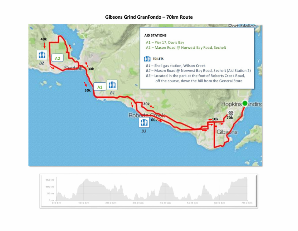
Gibsons Grind Gran Fondo
  • Home
  • Register
  • Event Info
  • BBQ
  • Rules
  • Blog
  • Photos
  • Contact
  • About

​70 km route

While it's actually only 21 km longer than the 50 km course, it's significantly harder.  That extra 21 km includes 369 meters of extra climbing,  ​

70 Km Route

While it's actually only 21 km longer than the 50 km course, it's significantly harder.  That extra 21 km includes 369 meters of extra climbing,  

The route starts as the 50 km route (see the 50 km route description for more details of the route) but continues onward to Sechelt from Davis Bay. Once in Sechelt the route winds past Porpoise Bay with some spectacular views of the local mountains surrounding the bay before climbing back towards Highway 101 through some beautiful rural farmland on its way to the 2nd aid station and a pass through the Southern waterfront of Sechelt. After leaving Sechelt, the route heads back towards Gibsons, leaving Highway 101 for a jaunt through Roberts Creek, home of the popular Gumboot Cafe before winding its way back to Persephone Brewing Company, site of the finish and the BBQ.
Picture
Road Hazards

There are some steep hills on the route. Some are in excess of 8% and quite long.  This can result in high speeds so make sure your brakes are in good working order.  A few of the hills have sharp turns or intersections with stop signs at the bottom.  Please be careful.  

Traffic - It is a weekend and this is not a closed course so there will be traffic on the roads.  Be careful and make sure that it is safe to proceed.  Look before making any turns and lane changes,  or when approaching uncontrolled intersections.

Condition of the road  - The shoulder along the routes is in some places narrow and in less than perfect condition.  Stay alert for hazards, and if you are riding in a group and you are up front, pay extra attention and clearly call out hazards out.  

Watch out for wildlife. This is a rural area. Deer and other wildlife are not unexpected.

GPX,KML,PDF Files

gibsons_grind_70km.gpx
File Size: 99 kb
File Type: gpx
Download File

route_70_km.kml
File Size: 45 kb
File Type: kml
Download File

route_70_km.pdf
File Size: 491 kb
File Type: pdf
Download File

Downloadable GPX, KML and PDF data files for your gps, google earth, phone devices
Powered by Create your own unique website with customizable templates.
  • Home
  • Register
  • Event Info
  • BBQ
  • Rules
  • Blog
  • Photos
  • Contact
  • About